Guide NaviBoss help
How to plan a voyage in NaviBoss
Plan a port-to-port route on real shipping lanes, set your speed and departure, keep clear of passages you do not want, and send the route on.
The planner draws the route a ship would sail: along the traffic lanes, round the capes, through the canals and keeping right in every separation scheme. It gives you the distance in nautical miles, the time at sea and an ETA you can share or load on the ECDIS.
#Plan your first route
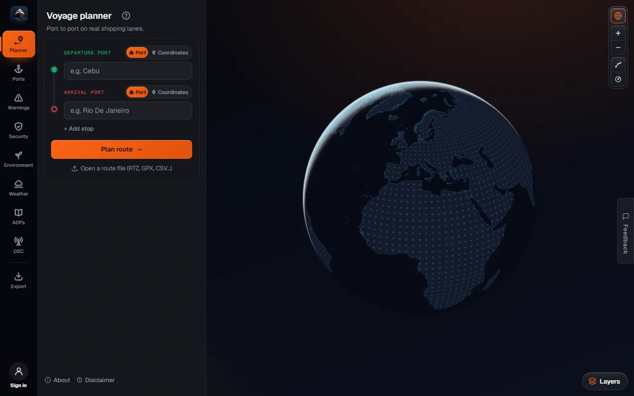
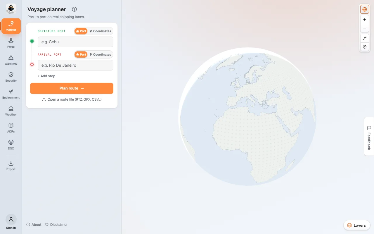
1 of 4 Click Departure Port and type the port you sail from.
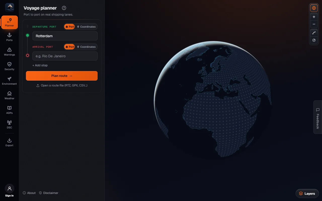
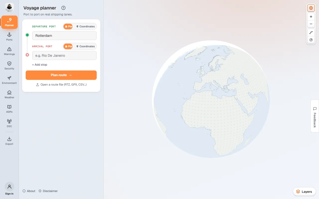
2 of 4 Pick the port from the list. The route starts at its pilot station.
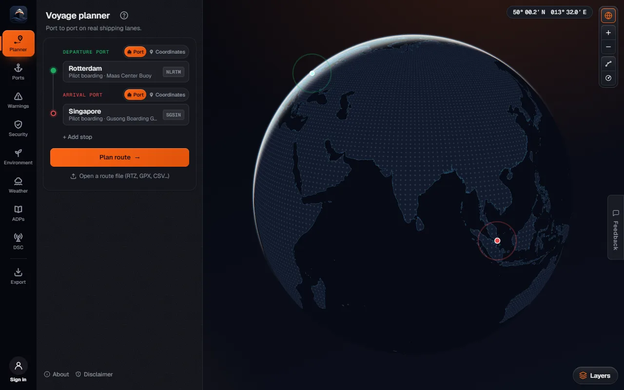
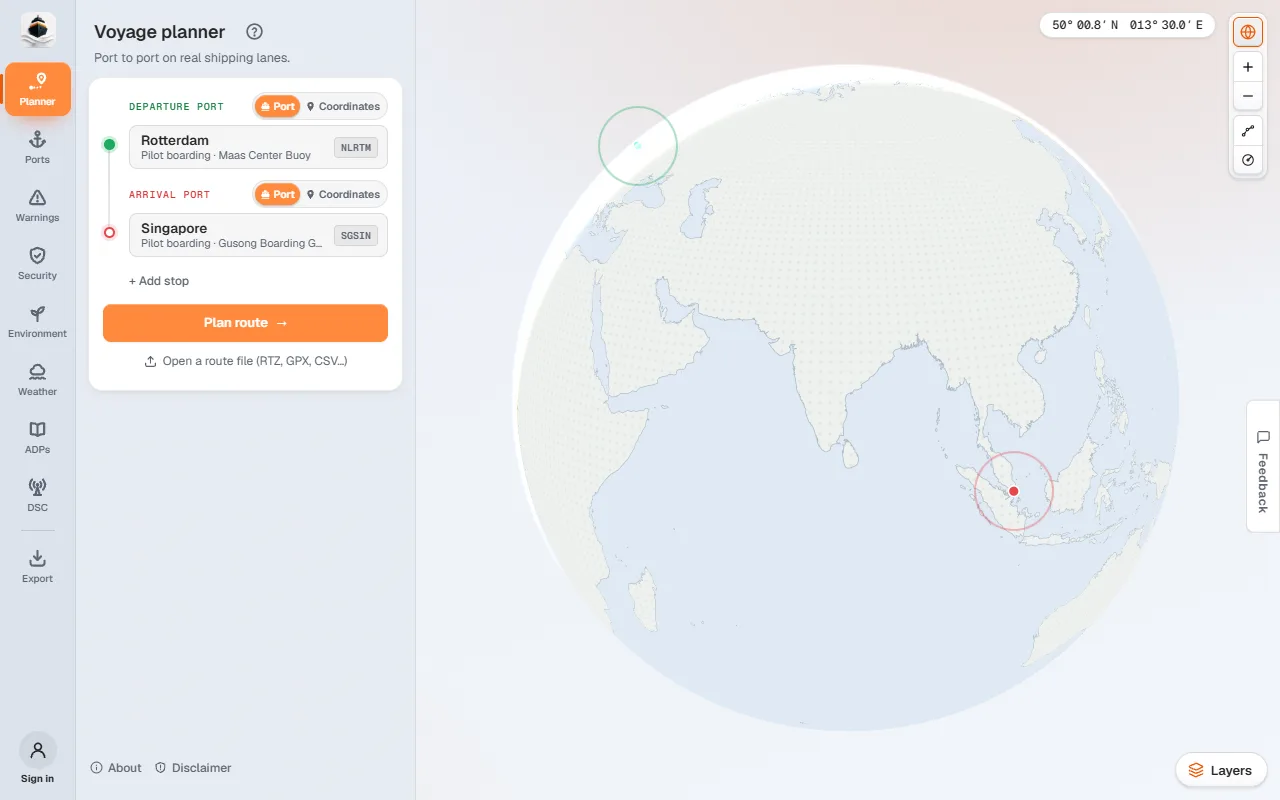
3 of 4 Fill in Arrival Port the same way, then press Plan route.
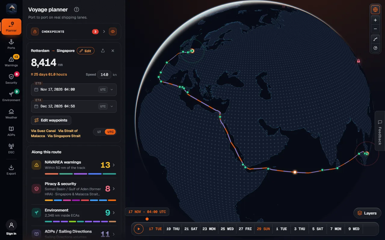
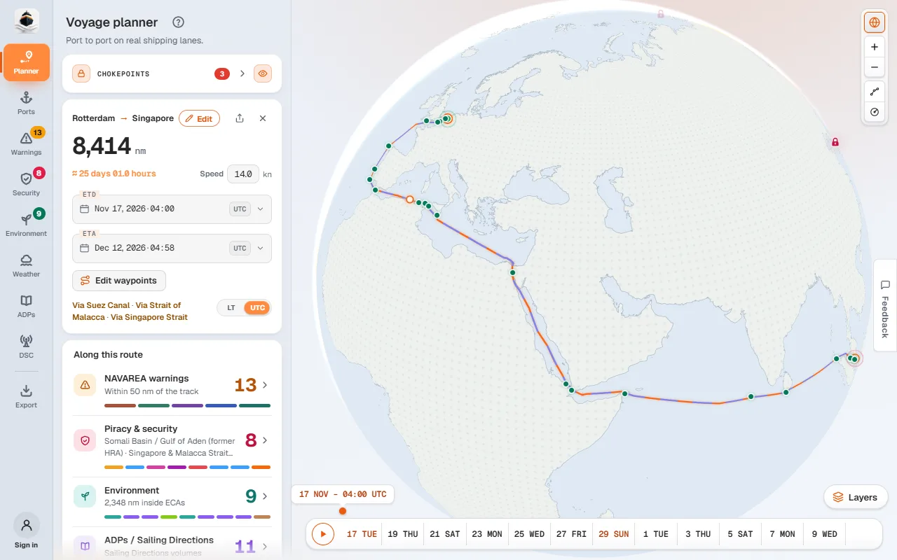
4 of 4 The route is drawn. The voyage card shows the distance, the days at sea and the ETA.
Type where you sail from
Click Departure Port and type a port name, a UN/LOCODE (
NLRTM) or a country. Pick the port from the list. A port is taken at its pilot station, so the distance runs pilot to pilot.Type where you sail to
Do the same in Arrival Port. Need a call on the way? Press + Add stop and it goes between the two.
Press Plan route
The route draws on the chart and the voyage card shows the distance, the days at sea and the ETA.
#Read the voyage card
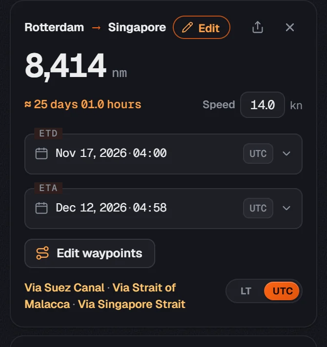
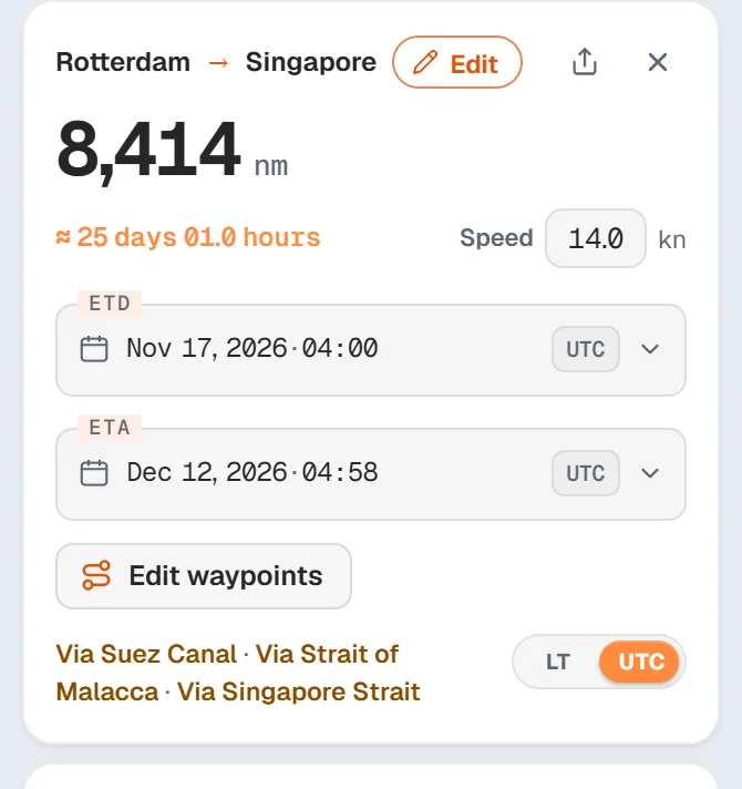
- Distance is in nautical miles, measured along the route.
- Speed is your planned speed through the water. Change it and the ETA moves.
- ETD is your departure. Change the ETA instead and NaviBoss works out the speed you need.
- LT / UTC switches both times between UTC and the local time at each port.
- The line under the times names the canals and straits the route goes through.
#Keep clear of a passage
Some passages you may not want: a strait you are not allowed through, a canal you cannot fit, or a risk area. Every passage on the route has a padlock.
Open Chokepoints
It is the first card in the planner. It lists every passage on this route.
Lock the passage
Press block beside it, or click its green padlock on the chart. Point at a padlock first to see the new route as a dashed line, with the miles it adds.
Open it again
Locked passages stay in the Avoided list. Press the × to open one again.
#Change the route by hand
- Drag the route line with the mouse to add a waypoint there. The new distance shows while you drag.
- Drag a stop's dot to move it. It becomes a position instead of a port.
- Right-click the chart (long-press on a phone) for Depart from here, Route via here and Sail to here.
- Edit waypoints on the voyage card opens every waypoint as a list you can change.
#Along this route
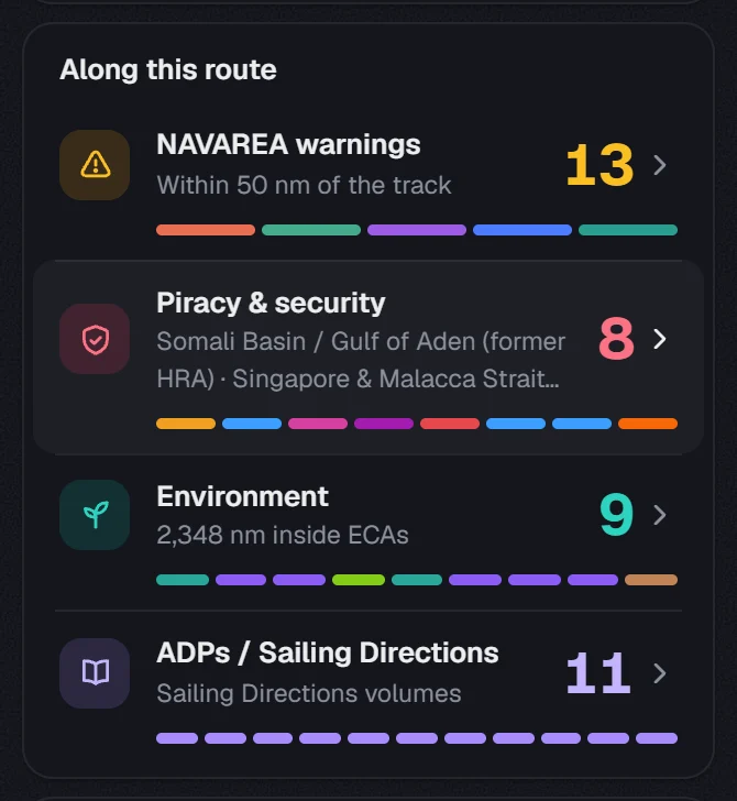
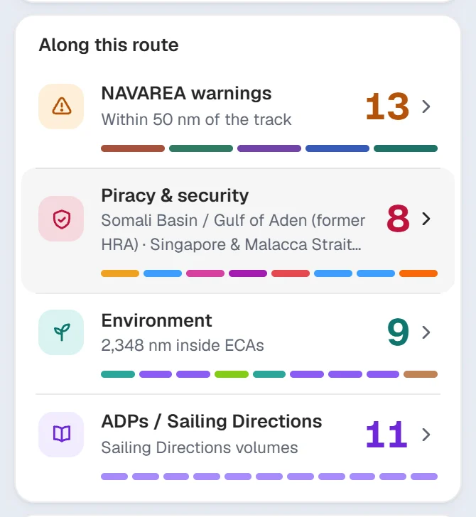
Under the voyage card, Along this route counts what the route meets: NAVAREA warnings near the track, piracy and security areas, Emission Control Areas and the ADMIRALTY publications you need. Click a line to open that tool. You can also straight away.
#Share, save and export
- Share gives a short link. Whoever opens it sees the same route, read-only.
- Every route you plan is kept in Routes under the card, so you can compare two plans.
- Export to ECDIS / plotter writes the route file for your ECDIS. The Export guide shows each step.
#Open a route file
Press Open a route file under Plan route, or drop the file on the chart. NaviBoss reads RTZ, GPX and the ECDIS route lists it can export. The route stays exactly as the file has it. Opening files is free.
About our guides
NaviBoss guides are written and checked by maritime industry experts, masters and deck officers. Each one is built from the same data the planner uses, dated, and rebuilt when that data changes. Spotted something wrong? Tell us on the feedback board.
A planning aid, not for navigation. Check official charts and publications, the latest notices and your company's instructions before you rely on any figure here.
Free Ready when you are
Try Voyage planner on your own voyage
Free account, no card. The same tool this guide shows.
Open Voyage plannerFree account · no card