
Guide NaviBoss help
How to measure distance and bearing on the chart
Draw a line point by point to measure the distance and course of every leg and the total, like a pair of dividers and a parallel ruler on the paper chart.
Line measures on the chart, leg by leg: the distance and the course of each leg, and the total at the end. It is the second of the view buttons at the top right of the chart (three dots joined), under zoom. Draw as many lines as you like; they are numbered Line 1, Line 2 and so on.
#Draw a line
Press Line
The button lights up and a pill at the top of the chart says what a click does now.
Click the first point
Click where the line starts. Any tool can be open.
Click each next point
A dashed leg follows the pointer until you click. Each click adds a point and a new leg.
Finish the line
Press Finish in the pill, press Esc, double-click, or click the last point again. Right-click gives Finish too.
You can also start a line from the chart: right-click where it should start and choose Start a line here. On a phone, press the measure button in the capsule at the top and choose Line; tap to add points and tap the last one to finish.
#Read the numbers
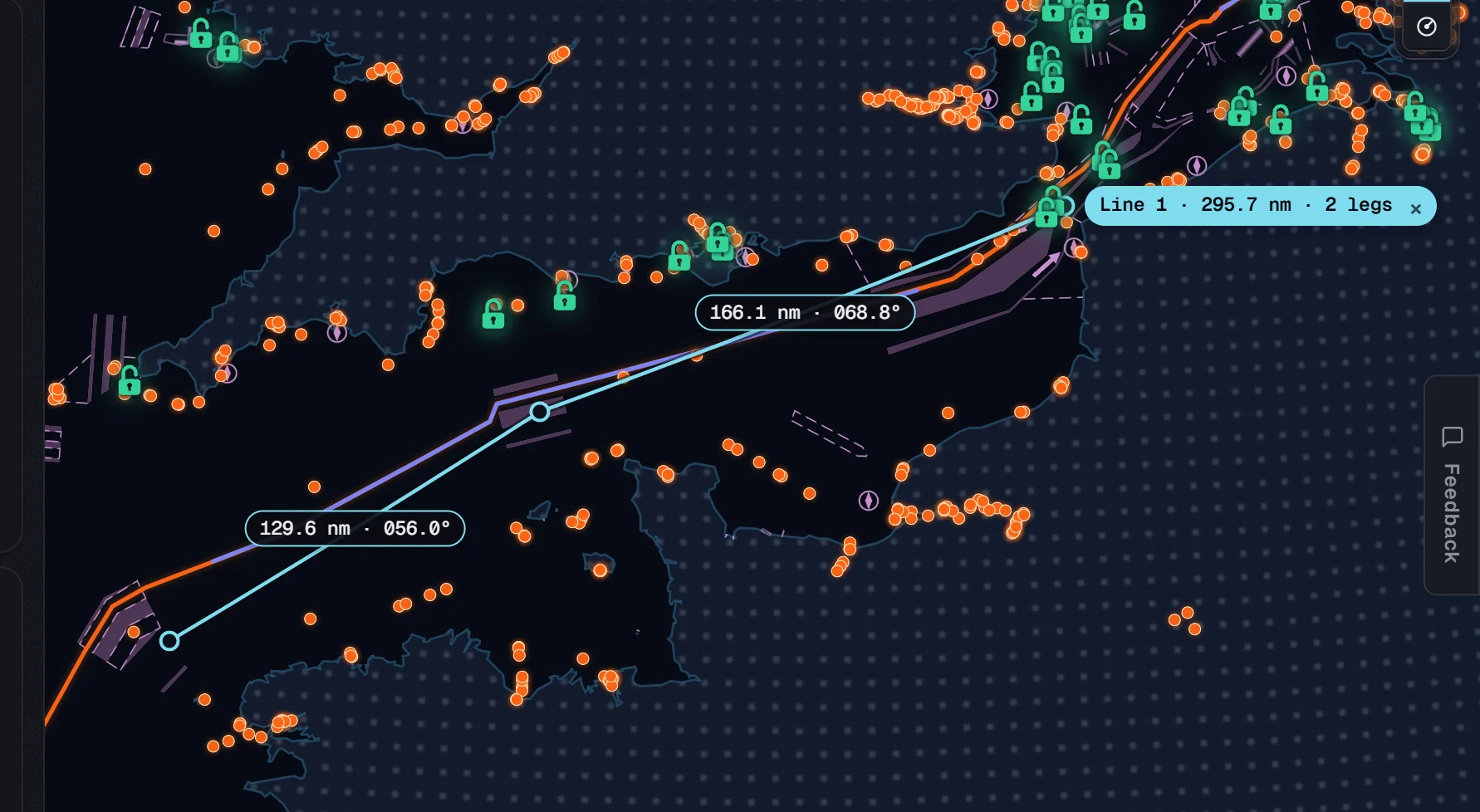
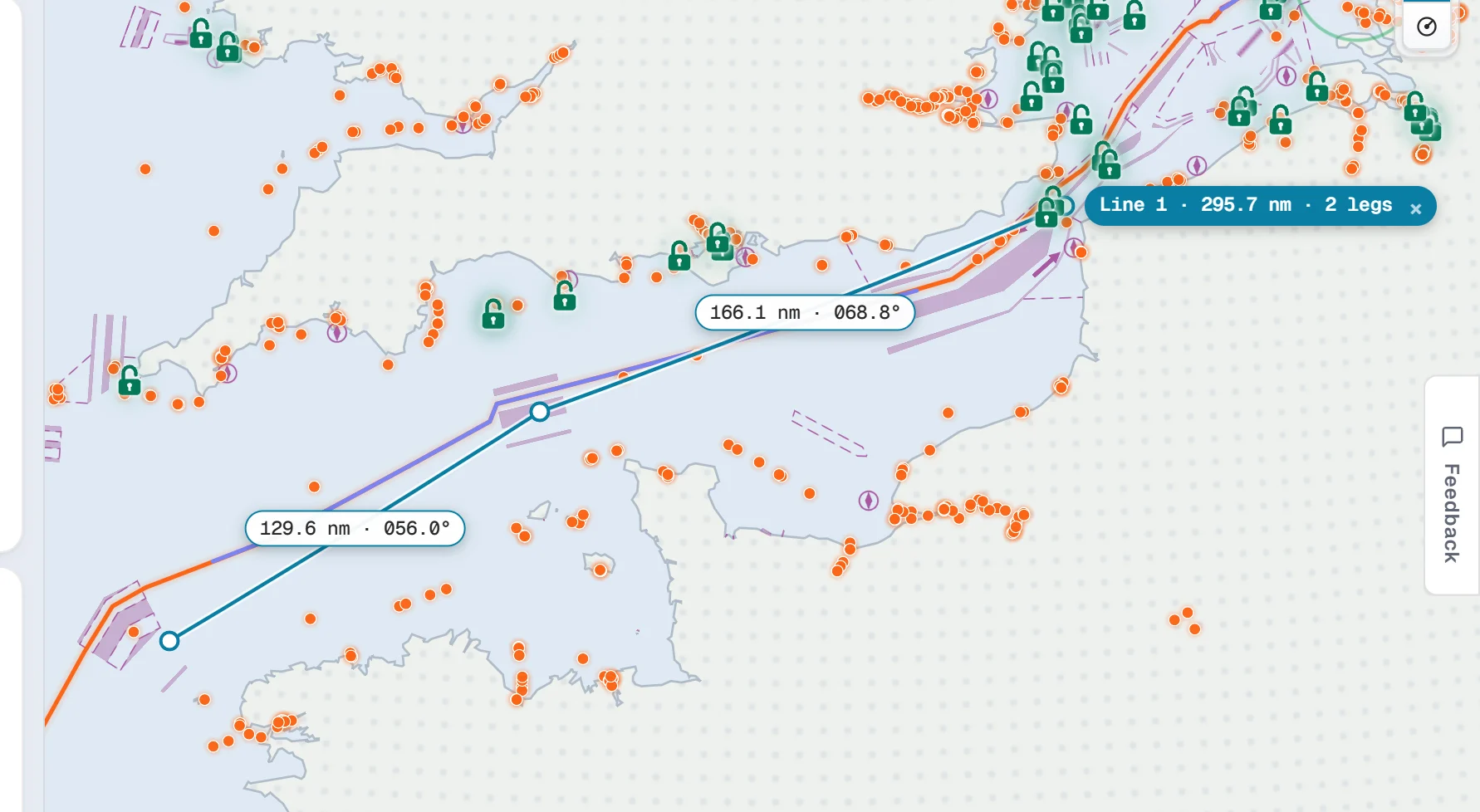
- Each leg is labelled with its distance and its course in degrees true.
- The end of the line carries the total, for example Line 1 · 295.6 nm · 2 legs.
- The legs are rhumb lines: one course from end to end, straight on the flat chart, as you would lay them off with a parallel ruler.
- Distances are in nautical miles, or kilometres if you chose them in Settings › Units & formats.
#Change a line
- Add a point: click on a leg. A new point goes in there and both legs are measured again.
- Move a point: drag it.
- Carry on from an end: right-click the first or last point and choose Continue from this end.
- Take a point out: right-click it and choose Delete this point.
On a phone, hold your finger on a point for half a second to get the same menu.
#Delete a line
Press the small × on the line's total. Undo shows for a few seconds if you change your mind (Ctrl + Z works too). To delete every line and VRM at once, right-click the chart and choose Clear all lines and VRMs.
To measure a range and bearing from one point, use a VRM instead.
About our guides
NaviBoss guides are written and checked by maritime industry experts, masters and deck officers. Each one is built from the same data the planner uses, dated, and rebuilt when that data changes. Spotted something wrong? Tell us on the feedback board.
A planning aid, not for navigation. Check official charts and publications, the latest notices and your company's instructions before you rely on any figure here.
Free Ready when you are
Try Line on your own chart
Free account, no card. It is on the planner's chart.
Open the plannerFree account · no card