
Guide NaviBoss help
How to switch between the globe and the flat chart
Turn the chart into a globe to see an ocean passage as it really runs, or back into a flat chart like the one on your ECDIS.
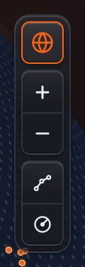
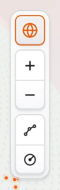
The globe button sits at the top right of the chart, above the zoom buttons. It turns the chart into a globe and back into a flat chart. NaviBoss opens on the globe the first time.
#Switch the view
Press the globe button
It is the round icon at the top of the view buttons. When it is lit, the chart is a globe.
Watch the chart turn
The globe flattens into the chart in under a second. Your route, the layers and the zoom stay as they were.
Press it again
The chart turns back into a globe. NaviBoss keeps your choice on this device for your next visit.
#When to use the globe
- Ocean passages. On the globe a great circle runs as it does at sea. A long route that bends north on the flat chart sits straight on the globe.
- Sizes as they are. The flat chart stretches land and sea towards the poles; the globe does not.
- Zoom in and it flattens by itself. Close in, the globe and the chart look the same. Zoom out again and it is a globe.
#When to use the flat chart
- It reads like your ECDIS. Mercator, north up, every rhumb line straight.
- The edge rulers. With the Coordinates layer on, the latitude and longitude scales along the chart's edges show only on the flat chart. On the globe the meridians curve, so a straight ruler would be wrong.
- Lines. A Line's legs are rhumb lines, straight on the flat chart: see the Line guide.
On a phone the globe button is in the capsule at the top of the screen, beside the day / night switch.
About our guides
NaviBoss guides are written and checked by maritime industry experts, masters and deck officers. Each one is built from the same data the planner uses, dated, and rebuilt when that data changes. Spotted something wrong? Tell us on the feedback board.
A planning aid, not for navigation. Check official charts and publications, the latest notices and your company's instructions before you rely on any figure here.
Free Ready when you are
Try Globe / chart on your own chart
Free account, no card. It is on the planner's chart.
Open the plannerFree account · no card